


2009-11-11
Tyng-Ruey Chuang
trc@iis.sinica.edu.tw
Institute of Information Science
Academia Sinica
Taipei, Taiwan
SVG is a language for describing two-dimensional graphics and graphical applications in XML.
The corresponding SVG path element for the GML polygon:
<g id="id513">
  <path class="SF93110"
    d="M 311121.467,2770626.411
       L 311146.177,2770623.712
       L 311146.784,2770629.019
       A 12.5147  12.5147  0 1 1 311121.849,2770631.02
       A 64.99423 64.99423 0 0 0 311121.467,2770626.411
       Z"/>
</g>
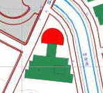
Result (the polygon is in red):
Check out this Academia Sinica map.
A scenario: "Online Aggregation and Visualization of Census Data: Population Mapping with SVG, XML, and Free Software" (SVG Open 2002).
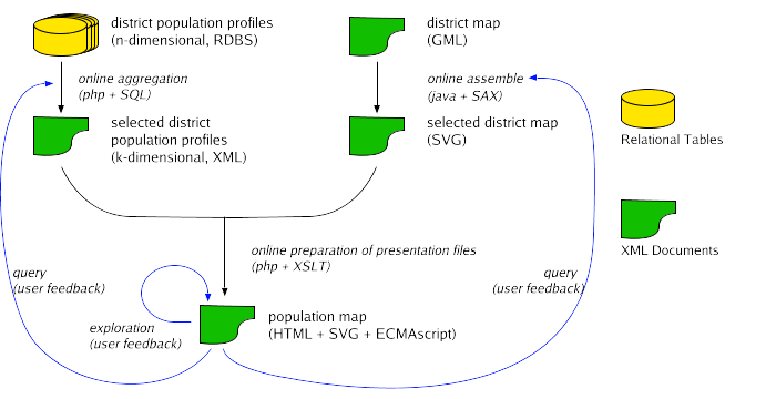
We focused on standards and tools for information visualization and XML processing.